So far, I have been able to stick to the schedule I initially planned for, with some severe difficulty. Though I intend to spend more time trying to figure out how to better build the “walls” of the track.
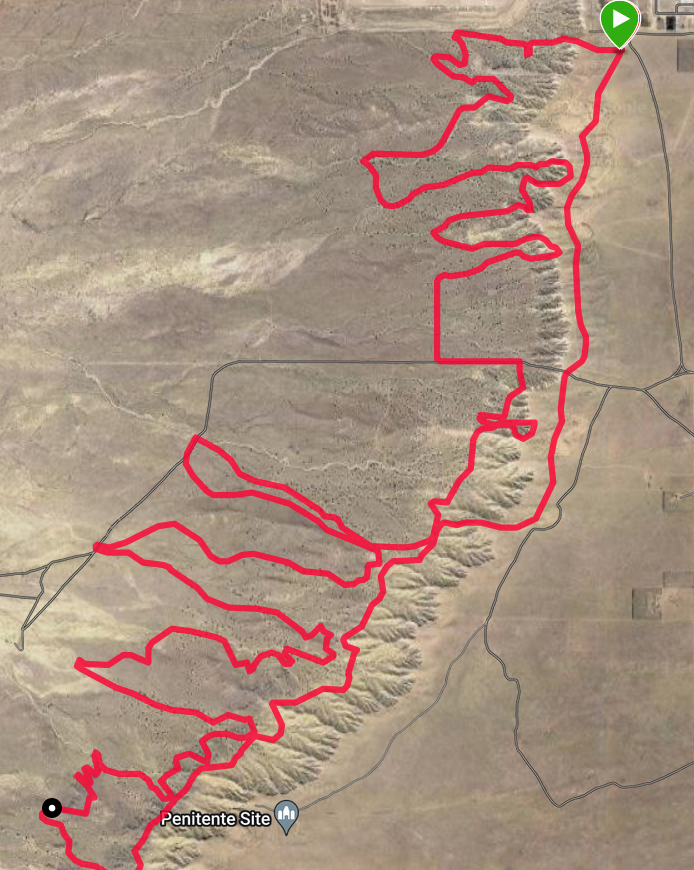
Pictured below is the first print of a flat/planar version of the track, compared to what is recorded by the watch:
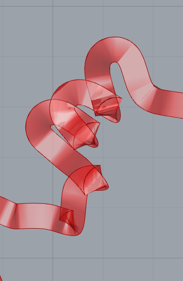
The major problem I have been attempting to resolve is when I add elevation to the mix. The offsets provided by grasshopper are not compatible with non-planar curves. After experimenting for some time, the best way forward seems to be to create the flat planar curve as above, and then sift through all the points on both the regular and offset curve and adjust their elevation.
I did implement this, but it is not ready to print yet, as I am having issues aligning the inner and outer points.
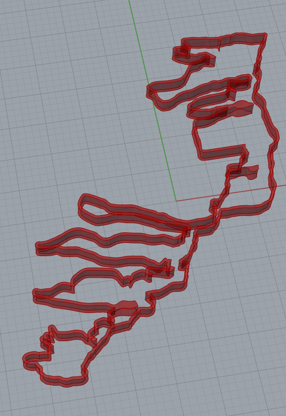
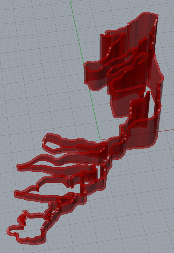
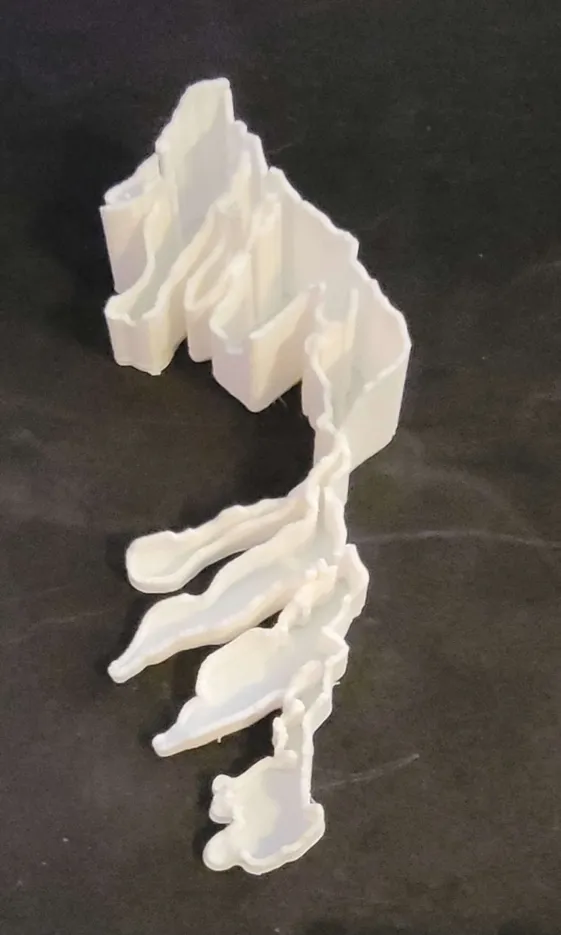
After doing some more random testing, I somehow was able to create a printable shape using Offset Surface from the lofted non-planar curves. Each corner of the shape is not as smooth as the flat curve, but it does print. I intend to try and figure out how to better smooth this out, and if thats not possible, correct my previously described functions.
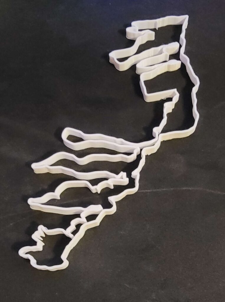
Pictured below are what the curves look like in rhino, and the printed model:
The deliverables I have are still the same:
– Print a map of the track we ride, including elevation/height
– Print a map of the track, with speed instead of elevation
– Print out smaller sections of the track to view data more precisely
Timeline:
November 2: Find a way to convert the GPX data that I have to a usable filetype or dataset -COMPLETED
November 9: The GPX data is all in latitude/longitude coordinates. I want to convert those coordinates to another coordinate system I can use. – COMPLETED
November 16: Tracing out the shape may be difficult, I intend to spend this week figuring out how to create a printable shape with walls and a base. Run the first print. – COMPLETED??
November 30: Use other pieces of data that are collected to change the print (heart rate, speed, temperature) continue to dial in printer settings to get the most detail in each print. – IN PROGRESS
Hello Andy, your project is coming along great. I liked how you figured out how to integrate the elevation of the trail into your prints. I can’t wait to see the final prints!
Thanks! It took a while to figure out how to get elevation out of the .gpx file but it worked out.
Hi Andy! This is such a cool project and I love that you are using data that you’ve collected yourself. Looking forward to seeing the final project!
I’m glad you like it! I’m glad I was able to actually use the data off of this watch outside of just looking at it on my phone.
This is so cool Andy! I really like the idea of using your watch to gather personal data.
Thanks! I’m glad I was finally able to use the data off of this watch in an interesting way!